Wednesday 3 October 2012

Morte Point to Bull Point

While on holiday at Twitchen House Caravan Site we took the opportunity to walk more of the SW Coast Path.   We started by walking from our caravan down to the village of Mortehoe.  From there we followed the signs to Morte Point.  This took us along a grassy path to the end of the Point where we tracked down to the South West Coast Path.  The views were spectacular!

The direction we were going to be walking 

Looking back to Woolacombe Beach
This part of the coastline is a known habitat for nuthatches.  As we walked along we saw one at the side of the path.  He was not moving so we don't know if he was injured or 'playing dead' as scared of us.


The path, as often the case with the South West Coast Path, went up and down, but the views were worth the effort. 

Bull Point with Rockham Beach in foreground
We walked as far as Bull Point with the lighthouse, then followed the access road back to Mortehoe.  This was a much easier walk, with gentle hills, but it was not so interesting with high hedges either side.  The road led back to the centre of Mortehoe.  Instead of walking back on the road to the caravan site we decided to walk back to the South West Coast Path and follow it to Woolacombe.  It was a steep path to get to the Coast Path but once on to it it was a pleasant walk into Woolacombe.

Beach at end of Woolacombe with Morte Point

Saturday 28 July 2012

Slapton to Blackpool Sands


After a very hot week the temperature had dropped today so we were keen to do another section of the South West Coast Path.

We drove the car to Brixton then caught the 93 bus to Kingsbridge.  Although we could have stayed on the same bus all the way to Slapton, we chose to spend an hour in Kingsbridge and catch the next bus to our destination.  It was lovely riding on the top of the double decker with great views over the Devon countryside.

We got off the bus at the memorial at Slapton Sands and started to walk in an eastward direction.  We tried walking on the beach but the Sands were shingle and it was hard work walking on it.  The coastal path started being on the nature reserve side of the road.  There were lots of wild flowers and butterflies, but no view.  We were therefore pleased when the path crossed the road and went along the edge of the beach where there were far reaching views of  Start Bay.  There were wildflowers on this path as well.


At Strete Gate we left the beach and the main A379 behind and climbed steadily up an old road.  Unfortunately before long we hit the main road again and had to walk along this until we reached Strete (not good).  The other side of the village we walked across fields and soon had wonderful views around Start Bay.


After walking on further we stopped for lunch with fantastic views along the coast to Blackpool Sands.


We then had to walk down and up the Landcombe valley.  Both sides of the valley were very steep and going down the hill was very precarious.  We then cross the main road again and had to head inland across fields  before coming down to Blackpool Sands.


We had read that they had a large screen at Blackpool Sands so planned to stop there for a while watching the Olympics while enjoying the beach and being by the sea.  However the screen was situated in the car park, near the toilets, and there were no seats, so we did not stay long watching it, but just stayed on the beach until the next bus came.


Sunday 22 July 2012

Torquay to Babbacombe


Summer finally arrived on Saturday 21 July!  After over 6 weeks of wet and showery weather we finally saw clear blue skies so we could plan to spend a whole day walking.

We took the train to Torquay   (very crowded with others heading to the beaches).  With our ticket we purchased bus plus tickets so once we had arrived in Torquay we could use all the buses.  We took the bus from the railway station to the centre and then another bus to St Marys Church.  We walked down to Babbacombe Model Village then turned right and started walking back towards Torquay.

To begin with we walked along the top of the cliffs at the side of gardens and we could see all along the coast beyond  Exmouth.

Oddicombe Beach.  Recent heavy rain has cause a landslide
 Soon we came to the South West Coast Path and as usual there were plenty of ups and downs, but it was not too strenuous.  We kept near to the sea at all times, although we could not always see it because of the trees.  However, there were many good viewpoints to see the islands just off shore and rock formations.


We gradually worked our way down to see level at Meadford Beach and rewarded ourselves with a delicious icecream at the cafe there before we tackled the last hill up to Daddyhole Plain.  This is where we had got to last time we walked along the coast path from Torquay last year.  We knew it was only a short walk down to the town by road.  After stopping for a cup of tea in Debenhams looking out over the harbour we took the bus back to the train station.  It had been a lovely day and a lovely walk.

Monday 4 June 2012

East Soar to Overbecks


Today was a Bank Holiday and an ideal day for walking - cloudy, warm, and not windy.  We drove to the National Trust car park just past East Soar village and walked down to the coastal path.  To begin with we started to walk towards Soar Mill Cove as this was as far as we walked when we were parked at Bolberry Down.  It was further than we thought and when the path started to go downhill we turned around.

Looking towards Soar Mill Cove

We then started to do the walk along the SW Coastal Path we intended that we had downloaded from http://www.nationaltrust.org.uk/servlet/pdf/1/478925/Trail/Walking/Bolt_Head_walk.pdf.

To begin with the path was quite flat although there was a steep path up and down at Starehole Cove.   The walk was made even prettier by the foxgloves along the way.
 There were lots of paths around the area.  We kept to the SouthWest Coast Path although did not go right out to the end of Bolt Head. At this point we may have missed the path we were meant to be walking along, but we continued in the right direction, but maybe a little inland.

As we got nearer the end of the walk we had lovely views up the River to Salcombe


Before long we reached the National Trust property, Overbecks.  We should have walked past the outside of it and had to walk back to the entrance on the other side, but we came down the path by the side of the entrance, so we must have gone wrong somewhere!  The gardens were looking lovely with lots of unusual plants.


On the walk back to the car we had to walk through Tor Woods.  Leaving Overbecks we saw a signpost for this so we followed this path.  But in fact it did not lead us through the woods but at the side.  This meant we cut out a portion of the walk so we will have to redo this another time.  But it made the walk back to the car even quicker and it was a good flat path all the way from the edge of the woods.

Stoke Beach to Keaton Cove


A couple of weeks ago we walked from Mothercombe to Keaton Cove.  This meant we just had to walk from Stoke Beach to Keaton Cove to completely walk along the South West Coast Path from Plymouth to Soar Mill Cove.  So this is what we decided to do last Thursday (31May) .

The coast was looking lovely and there were occasional foxgloves out brightening the edges of the path.


To begin with the path was fairly flat and wide and good, but then there was a very steep drop down.  We decided instead of tackling this part of the path we went inland and walked along a path beside the road and then the road before coming back to the path after avoiding the up and down of the path.  This made the walk much easier.

Before long we reached the stile where we had stopped last time, so after having a snack we turned round and headed back.

Sunday 13 May 2012

Mothecombe to Keaton Cove


Last year we walked the South West Coast Path, in stages, from Plymouth to Stoke Beach and from Wonwell to Bolberry Down.  We therefore wanted to walk the section from Stoke Beach to the River Erme.  This is 4.3 miles and as there are a lot of ups and downs we thought it would be too strenuous to walk there and back in one go.  As it was a beautiful sunny day we decided to walk about half of it and leave the other half to do another day.

We drove to Mothecombe and left the car in the car park there - for a £4 fee!  When we visited Mothecombe last time we walked down to the River Erme and along the coastal path from there towards Mothecombe beach.  This time we walked directly down to Mothecombe Beach, crossed it and walked up some steps to the path along the cliffs.

Mothecombe Beach, with Wonwell beach on the other side of the River Erme

The sea looked a beautiful azure colour and there was wonderful views in both directions.  There were lots of flowers along the path, gorse, bluebells, sea thrift.


The path gradually climbed uphill and there was one steep hill down that went into steps before winding upwards again.

After 50 minutes we decided we had walked far enough so we stopped at the still at Keaton Cove.  The view from here was wonderful and we could see the caravan site at Stoke Beach in the distance.


Saturday 7 April 2012

Teignmouth to Labrador Bay

We followed the instructions for this walk from the Jarrold Short Walks South Devon book.  This walk started at the car park in Shaldon but we went to Teignmouth by train and walked down to the sea front and then along to catch the ferry to Shaldon.  The flower beds in Teignmouth were looking very bright and attrative.


The walk started by going through the village of Shaldon along the estuary of the River Teign.  It was unfortunate that the tide was out - it would have been prettier at high tide.  Having passed the road bridge to Teignmouth we walked on to Gravel Point then turned up towards Ringmore.  This was a very pretty village with lots of thatched cottages.  The road steadily went uphill but we were rewarded by some wonderful views up the river Teign and towards Dartmoor.  When we turned into Butterfly Lane we hoped to see butterflies but it was a cloudy cool day so none were around.  However, there were more spectacular views including this one back to Teignmouth.


We had just commented what a lovely walk this was when we came to a very large puddle that completely engulfed the path.  We had to edge past it almost in the hedge, holding on to vegetation to stop up slipping in. Just at the end Andy's foot slip and went up to his ankle in red muddy water!  We continued on hoping there were no further 'puddles' but soon came to an even larger one.  We realised there was not way we could walk through this one, but fortunately spotted that someone had made steps up the side of the hedge and there was a very narrow path along the top of the hedge.  We carefully, slowly walked along here and managed to get past the pool of water.

When we got to the end of Butterfly Lane we could see down the coast to Labrador Bay.


We could have cut across to the South West Coast Path at this point but it would have meant walking along the A379 which is a busy road with no verges so we kept to the instructions in the book and walked inland for a while before going along the A379 for 200 yards before joining the SW Coast Path.  We were glad it was only this short a portion as it was a dangerous section.


When we got on to the SW Coast Path we started walking down a very steep  slope.  This gave us another viewpoint of Teignmouth.


The path continued making its way downward until we reached Shaldon.  We could have returned to Teignmouth and the railway station via the ferry, but instead decided to continue walking to the road bridge and walk across this back to Teignmouth.  It was a pleasant walk through Shaldon but on the other side of the river we had to go up a hill to get past buildings before we dropped down into Teignmouth Town Centre and on to the railway station.

Thursday 29 March 2012

Mildendreath to Seaton

Although it was only March it was a hot day, the forecasters saying the temperature would reach 20C.  We drove to Mildendreath, where it was free to park and walked to Seaton.  We knew before we set off that there were lots of ups and downs, but lunch at the cafe on the beach at Seaton was a good incentive.

There was a steep hill to climb out of Mildendreath, first on the road and then on a well defined path.  The views from the top were worth the effort.  Initially we could see across to Looe Island and Hannafore.  Later on in the other direction we could see around to Rame Head.


There were lots of flowers at the side of the path - primroses, violets, daffodils, gorse, hawthorn, pink campion and the occasional bluebell.  Butterflies were also fluttering around and we saw peacock. tortoiseshell, small blue.


There were picnic benches at the top of Bogdigga Cliffs but there were no other seats along the path.  And it was a very strenuous walk, going up and down, sometimes on steps.  It was a 2 1/2 mile from Mildendreath to Seaton but it took us 1 1/2 hours.  At times the path went through trees, but most of the time we were in the sunshine and it was very hot!  When we came out of the path there was a steep flight of steps that led to a road that went down to Seaton


After our lunch at Seaton we headed back the same way.  To begin with it did not seem to bad a walk, but as we went on it became very hot and it was hard work.  This was the most strenuous walk we have done to date, and I would not want to repeat it!  However, we can now say that we have done all the South West Coast Path from Plymouth to Polperro.

Saturday 24 March 2012

Jennycliff to Bovisand

We had done this walk back in August, but that day my camera was not working properly so I wanted to re-do it and take photos.  When we did it last year part of the South West Coast Path was closed due to a landslip and we had to walk a small section on the road.  Today the whole path was open.

Although the forecast was for a sunny day there was a sea mist that meant you cold not see Cornwall clearly.  I waited to take my photos on the return journey but the backgrounds were still not very defined.

There were a lot of steps at the beginning of the walk, first down then up but after this the path went gradually up and then down before more steps just before the end.  There were Devon violets along the side of the path to remind us which county we were in.


There were spectacular views of the Sound. into Plymouth and out to the Breakwater.  It was a pity it wasn't a clearer day.


It was low tide so there were large beaches at Bovisand and Sandy Parlour.

Bovisand Beach with the Breakwater in background

Sandy Parlour, with Bovisand Fort

Thursday 22 March 2012

Exmouth to Budleigh Salterton, Sidmouth and Seaton


Wanting to do some of the South West Coastal Path in East Devon we rented a caravan at Sandy Bay on the outskirts of Exmouth.  The Coastal path went round the side of the caravan site so it was very convenient for walking.

Sandy Bay
We set off from the caravan at 8.30 in the morning and within a couple of minutes we were heading towards Budleigh Salterton.  The coastal path was more undulating that we had anticipated, but the views were worth the effort.  We could see across to the River Exe and inland as well as the sweep of the bay towards Budleigh Salterton with the distinctive red cliffs.


  As we started to walk down towards the town gorse bordered the path


When we reached Budleigh Salterton, after a quick look around the town we walked up the River Otter until the coastal path crossed the river to come down the other side to continue its way up the coast.  The clouds were gathering so we hurried back to the town, but soon we were caught in a heavy shower.  This soon passed and it had stopped raining  by the time we caught the bus to Exmouth.

After looking around the town centre in Exmouth and having a fish and chip lunch we headed to the sea front and started to walk back to the caravan.  This was a flatter walk with only one steep hill at the end of the beach up on to the cliff top.  This was near the Orcombe Point where the Jurrasic Coast starts, marked by the  geoneedle.

After walking along the cliff top we were soon back at the caravan at the start of our walk.

While in East Devon we also visited Sidmouth and Seaton.


At Sidmouth we parked just outside the town centre and walked through the Connaught Gardens to the path by the edge of the beach and along to the town centre.

Sidmouth


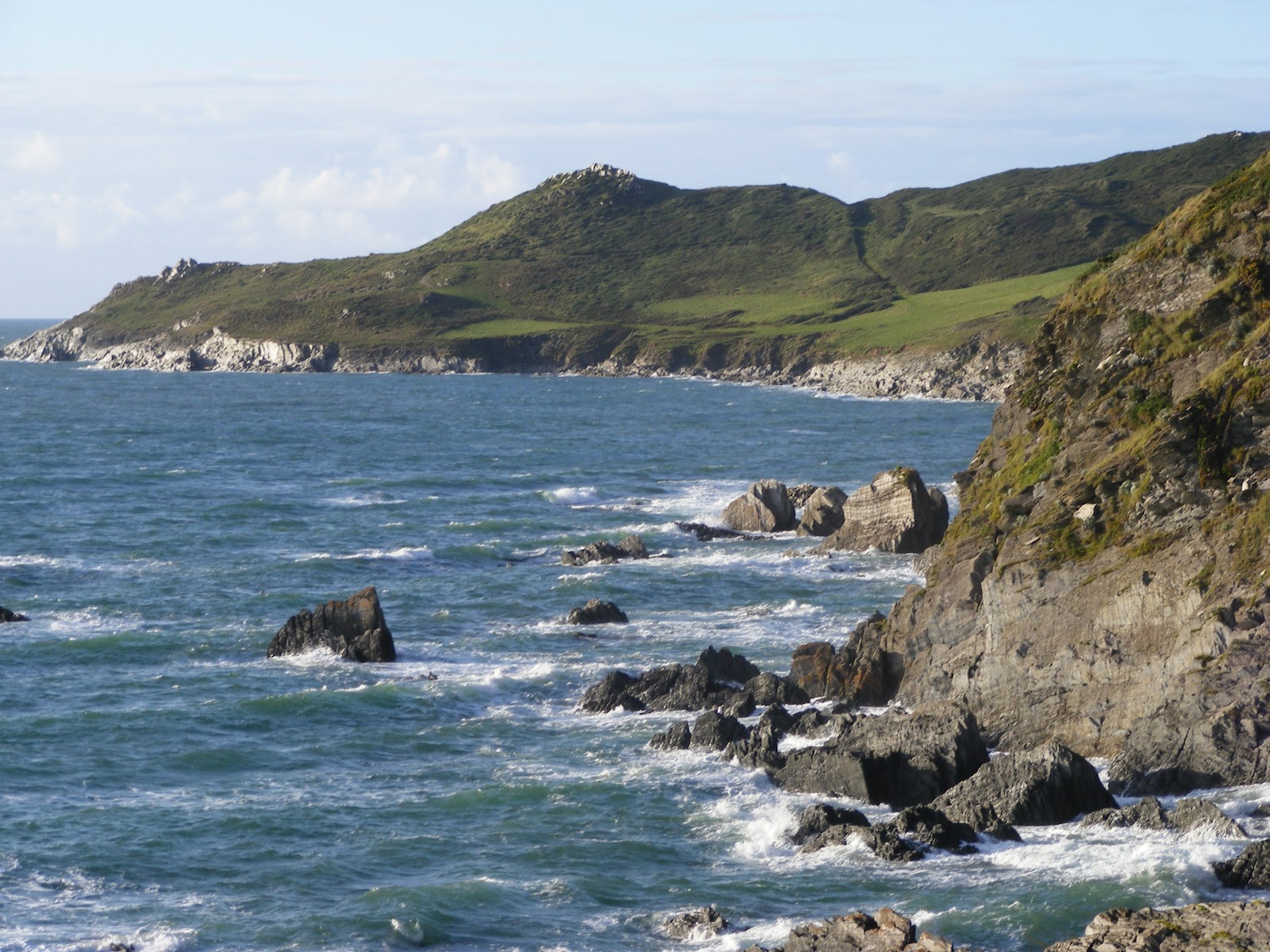
On another day we drove to Seaton, where we were surprised to see the cliffs were white, not red.


We parked the car near to Axmouth harbour and walked along the beach to the Tram station, not a long section of the South West Coastal Path, but a pleasant walk on a sunny morning.

Thursday 12 January 2012

Looe to Mildrendreath

We caught the train to Looe, a very pleasant train ride with beautiful views out of the carriage all the way. As we approached Looe there were many birds in the river - herons, egrets, curlews as well as gulls and ducks.

After walking around Looe and having some lunch we followed the South West Coast Path towards Mildenreath.  There was a long steep climb up from Looe town, but the view from the top of the cliff over the beach to Hannafore Point was worth the effort.


We continued walking around the coast.  There was a proper path all the way, and we were often on quiet roads between attractive houses.  After we had gone down to Plaidy Beach we had to go up another hill and then down a long hill with steps to Mildrendeath.


We then turned around and walked back to Looe.  It had been an ideal walk for a winter's day when other paths would have been muddy.