Sunday 1 December 2013

Cremyll to Cawsand

It was a bright sunny day so we thought we would do a walk along the South West Coast Path. We have often  done the part of the walk that goes through Mount Edgecumbe Park but not all the way to Cawsand.  Looking back on this blog I see that it was 28 February 2013 when we last did the whole stretch, just a couple of weeks after moving to Plymouth.

We parked the car at Devils Point and took the South West Coast Path through the Royal William Yard to Admirals Hard where we caught the ferry to Cremyll.  Although there has been rain lately the path was not too muddy.  It was not too hard a walk until we got to the steps.  Usually we go up one flight of steps then turn back to Cremyll, but this time we had to continue to the top and it was a hard slog.  However, once we had conquered them it was easy walking all the way.

Twice on the way we saw deer but they ran away before I could photograph them.  There were still some leaves on the trees, but not many and not much autumn colour.  The views out to the Sound, however, were beautiful.

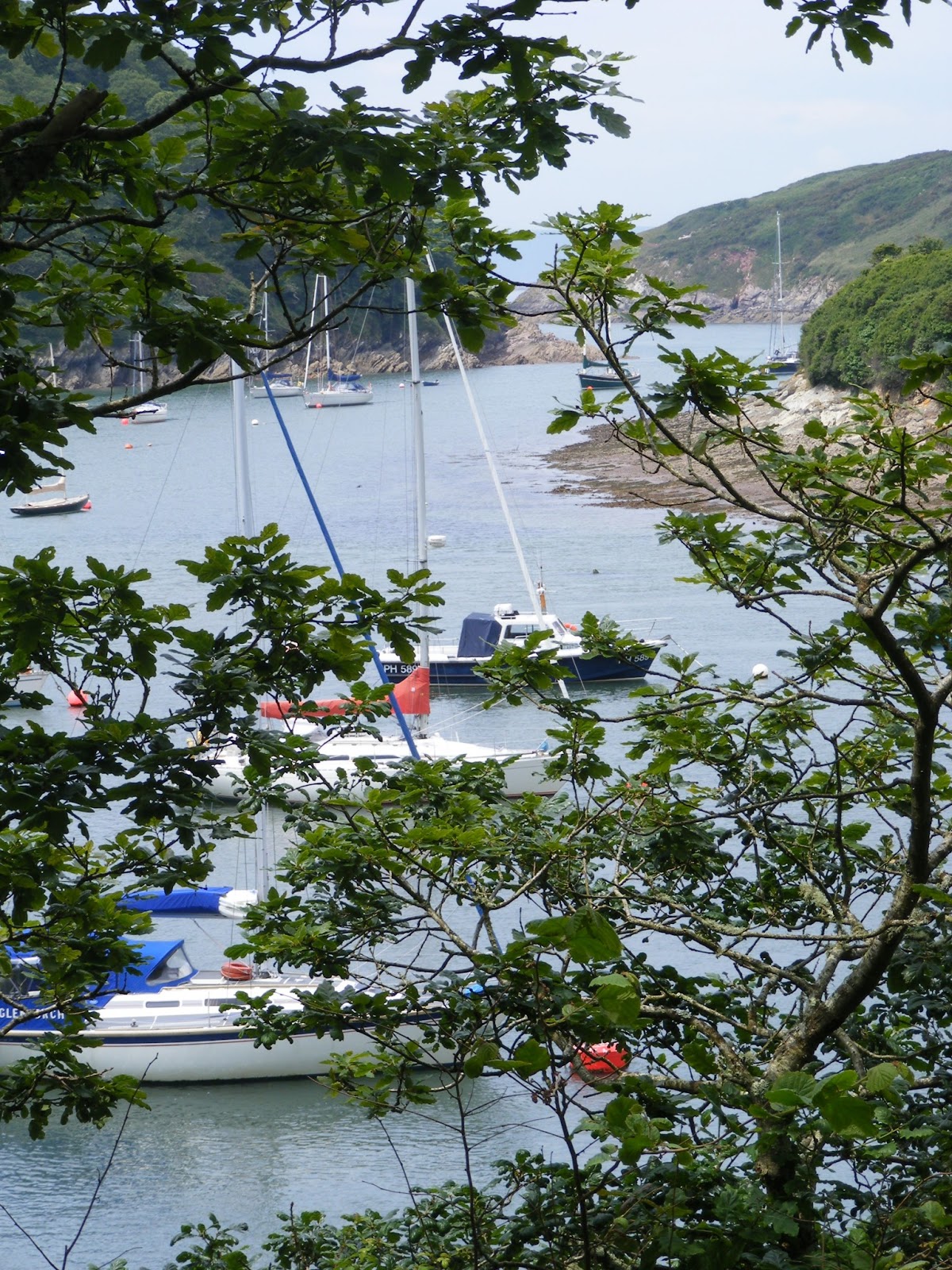
View to the Breakwater and Mew Stone

The walk is about 4 miles and we were surprised how quickly we saw the villages of Kingsand and Cawsand.  At this point we stopped for lunch on a bench looking out to sea with the sun shining on us.  It was really warm for the last day of November.

Kingsand and Cawsand
Walking through the narrow streets of Kingsand we were charmed by the quaint old cottages. We noted that the car park in this village was £1 for 6 hours.  I am sure this is a winter rate, but worth remembering if we want to come in this direction by car.

View through a garden gate, Cawsand

Cawsand was in shadow and a little chilly so we decided not to linger but catch the next bus back to Cremyll.  Fortunately we only had a couple of minutes to wait,  The bus ride itself was very pretty with views over woods and fields to Millbrook and across to Plymouth.  The tamar bridges stood out in the sun. The bus links with the ferry so we were soon back home.

Monday 23 September 2013

Ilfracombe

While on holiday in Combe Martin we caught the bus to Ilfracombe to walk along the South West Coast Path around this town.  From  the Landmark Theatre we started to walk towards Torrs Park.  There was a steep path up to the cliffs and then a zig zag path up to a viewpoint, but the views along the way were lovely.
View back to Ilfracombe

Beaches at Ilfracombe


View up the coast towards Bull Point

View towards Ilfracombe and beyond
 On the way back we walked slightly inland, which was a gentler slope and took us through the National Trust Car Park and then through the gardens above the Landmark Theatre.  This was  much quicker than the route we had taken on the way out.

Once back in Ilfracombe we walked around Capstone Hill to the harbour.  The big attraction in the harbour is Damien Hirst's sculpture, Verity.  Unfortunately there was a fair in the harbour car park so it was not easy to see the sculpure without fairground vehicles being in the way.  Nevertheless, it was imposing although not particularly to my taste.


After eating our lunch watching gig racers practising and other boats bobbing around on the rough sea we headed back to Ilfracombe town to catch the bus back to Combe Martin to collect the car and visit Marwood Gardens.

Sunday 1 September 2013

Par to Fowey

We caught the train from Plymouth to Par - a pleasant journey as the train (the 9.24 to Penzance) was very quiet, having started in Plymouth.  From Par station we walked down to Par Beach a distance of about .75 miles.  We walked along the back of the beach on the dunes to the far end.  Par is a lovely large sandy beach, it is a pity about the industrial site at the side of it.


As we walked through the car park we missed any southwest coast path sign and so walked to the road and a long way around until we came to the southwest coast path from the Saints Way.  Once we were on the path it was easy to follow it to Fowey.  As usual the path went up and down, but the views were spectacular all the way.

A view back to Par Beach
 After a while we came to Polkerris and we thought this was a lovely beach and harbour.  The sand was fine and there was lots to watch as people were canoeing and windsurfing .  There was also a lovely art gallery there to browse around.

Polkerris
The next stop on our journey was  Gribben Head.  It seemed to be a long time before we saw the tower on the top of this headland and there was lots a climbing so we were glad to be able to rest when we got there.  Up to this point we had been having views of St Austell Bay, but once we were over the top we could see the River Fowey estuary and coast down towards Polperro.

View from Gribben Head


Looking back to Gribbin Head
The walk continued undulating, with some steeper parts, but it helped to see the finishing line.  On the outskirts of Fowey the path signage was confusing as there appeared to be 2 different ways you could take and still stay on the coast path!   Initially we stayed on the top path and started to walk through woods, but that took us away from the coast and so we turned around and headed down to Readymoney Cove.  This was another pretty beach and the walk into Fowey from here was lovely with views of the river and boats between houses.  

A view from Fowey

View across to Polruan
 Once in Fowey we spent an hour wandering among the shops and admiring the views before heading up the hill to catch the bus back to Par Station.  This had been one of the prettiest sections of the coast path we have done and well worth the effort expended.

Wednesday 28 August 2013

The Barbican to Mount Batten

On a couple of occasions we have walked on the South West Coast Path from Turnchapel to Mount Batten and we frequently walk around Plymouth Hoe to the Barbican.  However, we have never walked from the Barbican to Turnchapel.  As our car was being serviced at a garage on Billacombe Road, we thought we would remedy this today.

We started walking from the end of the Laira Bridge towards Mount Batten.  To begin with it was not the most pleasant walk, but we soon came to Oreston and there was a lovely view of yachts on the River Plym.


Mount Batten as  really close across the water, but we had to walk 2 miles  round the edge of the river.


We continued walking around Hooe Lake and across the causeway at the bottom of Radford Park.  the castle astride the path looked out of place.


We continued walking up through woodland and then down the other side till we came to Turnchapel.   It was a good path all the way and well marked.  Although we had walked from Turnchapel to Mount Batten before we continued our walk to Mount Batten before catching the bus back to the Laira Bridge.

From Laira Bridge we started walking towards the Barbican.  As with the first part of this mornings walk this section of the South West Coast Path is not very pleasant as you walk past industrial units, with just glimpses of the river Plym between them.  However, after a while we were opposite Mount Batten and it was interesting to see this from the other side of the river.


St Christopher on wall at side of South West Coast Path
Before long we were walking into the Barbican.  This was not one of the most picturesque parts of the South West Coast Pat, but there was still some beautiful scenery and I was glad I had done it.

Friday 23 August 2013

Bude, Coast and Canal

On the South West Coast Path website this walk,  http://www.southwestcoastpath.com/walksdb/34/, starts in Bude, however it was more convenient for us to start at Widemouth Bay and walk in the opposite direction

We anticipated that the car park by the beach at Widemouth would be expensive so drove past it to a car park on the cliff overlooking the beach.  We were very pleased when we got there to discover it was a free car park.  The car park led right on to the SW Coast Path and we were soon walking towards Bude.  The views were lovely, but probably been better it the tide had not been so low exposing all the rocks.  There was some heather and gorse in blossom on the cliff tops, but not as much as I had hoped.


The coast path was undulating, but there were not any really steep inclines.  Soon we were on the cliffs overlooking the beach at Bude, where we stopped for our lunch.


We proceeded to walk into Bude and crossed the canal to divert into the Heritage Centre which is situated in Bude Castle.  There was some lovely art work on display in the galleries here and the area around was attractively laid out gardens.  We were also impressed with the small craft shops along the edge of the canal.  After buying an icecream (and not been ripped off pricewise, which was refreshing) we started to walk along the towpath.  This was an excellent pathway and it was good to see people enjoying boating and canoeing along.  After passing a lock there were no more boats, and it was very tranquil.


After a couple of miles we came to Helebridge.  There was a large tea rooms here with activities for children, but we did not stop but headed across fields to return to Widemouth Bay.

This had been an excellent walk and one we would repeat again.

Wednesday 14 August 2013

Hallsands to Lannicombe

It was high tide as we drove through Kingsbridge, which made this part of the journey very pretty.  But once we turned off the A379 the road was very narrow and windy which was not good for driving.  The last part to the Start Point lighthouse was particularly narrow with vegetation brushing the car as we drove past.  For such a remote car park we were surprised that we had to pay £3.50, but the views around Start Bay were spectacular and made it worthwhile.


To begin with we walked out to the Lighthouse, which was a concreted path.  We then retraced our steps to the South West coast path and followed this around the Point.  To begin with this was a rocky path and we had to be careful how we walked, but the views were superb.


As we walked we were amazed at the number of butterflies we saw.  Many of them were landing on the path in front in front of us.


This moth was dead on the path


As we approached Great Mattiscombe Sands the path improved and the walk from there to Lannicombe beach was relatively easy and fairly flat with only gradual short climbs.  The beach at Great Mattiscombe looked lovely with fine sand.  Lannicombe was more stoney, though we could see that as the tide went out there was sand.  There were only a few parking spaces at Lannicombe at the end of a track so I am glad that we did not drive there.  We had planned to turn around at Lannicombe, which was fortunate as there has been a landslide just past there and the footpath has a long diversion.

Initially we planned to walk across the fields from Lannicombe to Hallsands, but the coastal path was so scenic and such a good path we decided just to retrace our steps to Great Mattiscombe Sands.  We then took the direct path back to the car park, which was uphill, but a good path.

After a rest we then walked from the car park down to Hallsands. Again we had fantastic views around Start Bay all the way and loads of white butterflies fluttering around the fern on the bank at the side of the path. It was very interesting to see the information of the lost village of Hallsands on the viewing platform overlooking the village.


As we walked back we had the view of the Lighthouse.  Unfortunately it was quite a climb back to the car park, not particularly steep but a long climb that was not good at the end of a day's walk.  It would have been better if we had parked at Hallsands, which was free, and walked from there, and then the last part of the walk would have been downhill.

Saturday 29 June 2013

Torcross to Hallsands

In the past we have walked from Starcross to Blackpool Sand along Start Bay.  Today was a lovely summer's day so we thought we would walk along more of Start Bay.

We drove to Beesands and were very impressed by this fishing village by the sea.  There were people fishing from the beach and boats in the bay.  Some fish were drying at the top of the beach.


We walked along the path at the top of the beach til the end and then climbed to walk to Torcross.  It was a steep climb, but the view half way up encouraged us to keep going.


After a while the path became steps and then levelled off before winding down to Torcross.  There were hedges both sides of the path and overhanging above it and unfortunately there were lots of insects flying around.

As we approached Torcross there were spectacular views along Slapton Sands.


Having taken a rest at Torcross we walked back to Beesands where we had fish and chips at the restaurant on the seafront.  You could taste that the fish was freshly caught.  Once refreshed and replenished we walked on towards Hallsands.  Although a climb up from Beesands this was not as steep as in the opposite direction and we soon reached Hallsands.  This was another small village with beach but without the facilities at Beesands.

Hallsands

View on walk back from Hallsands

Wednesday 26 June 2013

Warren Point to Noss Mayo

It was a fine summer's day and we wanted an easy walk not far from Plymouth.  The walk from Noss Mayo, along the Yealm estuary and around the coast along the Revelstone Drive to Warren point, seemed to be a good idea.  We chose to park at the National Trust car park at Warren point and walked down the path onto the coastal path and walked towards the mouth of the River Yealm.

In the past we have done this walk in the other direction, starting at Noss Mayo.  As we started out we noticed the wonderful view, over to Cawsand and as far as Rame Head.  We had not noticed these views when walking the other way around.


There were foxgloves growing at the side of the path and after walking for a while we came upon a purple field of foxgloves.


This is an easy  part of the south west coast path, with beautiful views and a fairly flat path.  Once we reached the mouth of the River Yealm we also had sight of the yahts.  After walking up the river Yealm we came to some benches so we stopped for our lunch, with a beautiful view.


We continued walking on to Noss Mayo and then walked up the hill past the tennis courts.  This road became a track and ended up, after a long upward climb by the entrance to the car park.  This was the only hill on the walk.

This 4.5 mile walk is described at  http://www.southwestcoastpath.com/walksdb/91/

Wednesday 1 May 2013

Pencarrow Head to Polruan

With the very wet winter and spring and subsequent landslips we have not ventured out onto the South West Coast Path very much at all this year so far.  But lately it has been dry and today was a lovely sunny day so we decided to walk the section of the coast from Pencarrow Head to Polruan.

We drove down to Looe a different way to usual as the normal road we use was still closed after the landslip.  From there we went on to Polperro and then followed the coast towards Polruan.  These were  very narrow lanes and not easy driving.  We parked at the National Trust car park at Pencarrow Head and walked across the field to the South West Coast Path.  We were following the walk in the NT website  Polruan coast and creek walk http://www.nationaltrust.org.uk/lantic-bay-and-lansallos/things-to-see-and-do/view-page/item933623/

When we reached the coast path there was a beautiful view of Lantic Bay and beach.


The walk along the coast path was steep up and down at times, but the views were worth the effort. There was gorse brightening the path and ocassional butterflies and birds flying around.  There were even a few bluebells.


View from top of Polruan towards Fowey

We walked down to Polruan and had our lunch sat on the quay, then started the Hall Walk up the Pont Creek.  This was a fairly flat section of the walk and took us through woodland with the creek always below us.  There were many bluebells in the woods and it will be a very pretty walk when these are fully out.


When we came to the end of the creek we had one more steep climb up the the church and then along the road back to the car.  A very pleasant walk!

Rather than return on the narrow lanes to Polperro we drove to Boddinick and caught the car ferry across to Fowey and drove home that way - a much better route than the one we took this morning